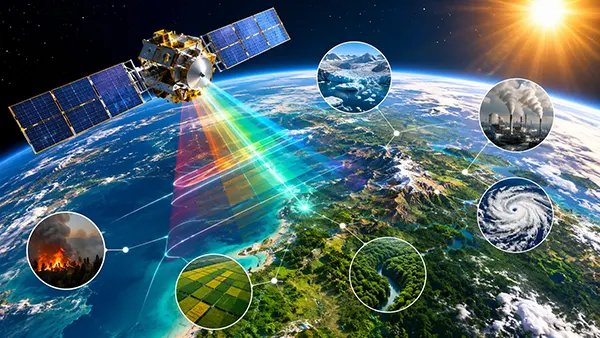
Climate monitoring has entered a new phase as satellite technology becomes more precise, autonomous and data-driven. Modern Earth observation systems launched between 2023 and 2026 can measure atmospheric gases, ocean temperatures, soil moisture and glacier movement with a level of accuracy that was impossible a decade ago. Governments, research institutions and environmental agencies now depend on these systems to track climate shifts in near real time. The latest satellite missions are not only improving scientific understanding of global warming but also helping societies prepare for droughts, floods, wildfires and severe storms.
Advanced Earth Observation Systems and Their Role in Climate Science
New satellite constellations are capable of collecting environmental data continuously rather than through isolated measurements. Missions such as the European Space Agency’s Sentinel programme and NASA’s Earth System Observatory provide uninterrupted coverage of oceans, forests and polar regions. By combining optical imaging, thermal sensors and radar technologies, scientists can compare climate conditions over long periods and detect subtle environmental changes earlier than before.
One of the most important developments by 2026 is the increased accuracy of greenhouse gas monitoring. Satellites including MethaneSAT and Copernicus CO2M are specifically designed to identify methane and carbon dioxide emissions from industrial facilities, agricultural areas and transport infrastructure. These observations help researchers determine where emissions originate and whether climate policies are producing measurable results. Countries can now compare independently verified atmospheric data instead of relying only on self-reported statistics.
Another major improvement involves high-resolution ocean monitoring. Modern satellites measure sea surface temperatures, ocean salinity and ice-sheet thickness with exceptional precision. This information is essential for understanding rising sea levels and shifting weather patterns. Climate scientists use these measurements to refine forecasting models and estimate how coastal regions may be affected during the coming decades.
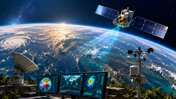
Artificial Intelligence and Real-Time Climate Data Processing
The growing volume of satellite data has made artificial intelligence an essential component of climate analysis. Modern observation satellites generate terabytes of information every day, far exceeding the capacity of manual interpretation. AI-based systems can rapidly identify anomalies such as illegal deforestation, wildfire outbreaks or unexpected methane leaks. This allows authorities to react faster and reduce environmental damage before it spreads further.
Machine learning algorithms are also improving climate prediction models. Instead of analysing isolated weather events, AI systems compare decades of satellite observations to identify long-term environmental trends. Researchers now use predictive models trained on historical satellite data to estimate drought intensity, glacier melting rates and tropical storm development more accurately than earlier forecasting systems allowed.
Cloud-based processing networks have additionally reduced the time needed to distribute climate information. Environmental agencies can now access updated satellite measurements within minutes after collection. This rapid availability supports emergency response teams during hurricanes, floods and forest fires. In several countries, satellite-based warning systems have already become part of national disaster management strategies.
Climate Monitoring from Space and Its Impact on Environmental Protection
Satellite monitoring has become one of the most reliable methods for protecting forests and biodiversity. High-resolution imaging systems can detect illegal logging activities, monitor forest degradation and estimate carbon absorption levels across large territories. Tropical regions in South America, Africa and Southeast Asia are now monitored continuously through international climate observation initiatives.
Polar research has also changed significantly due to new satellite technologies. Earlier monitoring systems struggled to provide frequent measurements in remote Arctic and Antarctic regions. Current radar satellites can operate regardless of darkness or cloud cover, allowing researchers to track glacier movement and sea ice thickness throughout the year. The collected data shows accelerating ice loss in several polar regions, providing additional evidence of long-term global temperature increases.
Modern climate satellites are equally important for agriculture and water management. Sensors capable of measuring soil humidity and vegetation health help governments assess drought risks before crop losses become severe. Farmers increasingly rely on satellite-based environmental forecasts to optimise irrigation and reduce water waste. These applications are particularly important in regions already affected by rising temperatures and unstable rainfall patterns.
Private Aerospace Companies and the Expansion of Climate Observation
Private aerospace firms have become major contributors to climate monitoring infrastructure. Companies such as Planet Labs, ICEYE and Maxar operate commercial satellite fleets capable of capturing detailed Earth imagery several times per day. Their systems complement governmental missions by increasing observation frequency and expanding global coverage.
Smaller satellites known as CubeSats are also changing the economics of climate research. Traditional observation satellites often required years of preparation and extremely high budgets. Compact satellite systems launched in large groups can now provide continuous monitoring at lower costs. Universities and research organisations have gained broader access to space-based environmental data as a result.
Public-private cooperation has become increasingly common by 2026. Governments frequently combine official climate missions with commercial satellite services to improve forecasting accuracy and emergency response capabilities. This cooperation has accelerated innovation while making environmental monitoring more accessible to developing countries with limited space infrastructure.
Future Challenges and Opportunities in Satellite Climate Monitoring
Despite rapid technological progress, satellite climate monitoring still faces several technical and political challenges. One major issue involves the enormous quantity of data generated every day. Environmental agencies require stronger computing infrastructure and international coordination to process and verify global climate observations efficiently.
Another challenge concerns orbital congestion. Thousands of active satellites now operate around Earth, increasing the risk of collisions and space debris accumulation. As more climate-monitoring systems are launched, international space agencies must establish stricter traffic management and debris mitigation rules to protect future observation missions.
Data accessibility also remains uneven across regions. Wealthier nations possess advanced infrastructure for interpreting satellite measurements, while developing countries may lack technical resources and trained specialists. International climate organisations are increasingly focused on improving open access to Earth observation data and supporting scientific collaboration between nations.
The Future of Climate Forecasting Through Satellite Innovation
Future satellite missions are expected to deliver even greater precision in atmospheric analysis. Researchers are developing hyperspectral sensors capable of identifying detailed chemical compositions within the atmosphere. These systems may improve the detection of industrial pollution, volcanic emissions and fine particulate matter linked to public health risks.
Quantum communication technologies are also being explored for future climate satellites. These systems could improve data security and significantly accelerate the transfer of environmental information between orbital networks and ground stations. Faster transmission speeds would allow scientists to analyse climate events almost instantly.
By 2026, satellites have become central to understanding climate behaviour on a global scale. Their ability to monitor oceans, forests, emissions and extreme weather events continuously has transformed environmental science into a far more precise discipline. As observation technologies continue to evolve, satellite monitoring will remain one of the most important tools for managing climate risks and supporting long-term environmental planning.